Importing Horizon profiles
The horizon profile may be defined manually by a set of (Azimuth/Height) points in degrees. These may be from on-site measurements (using land-surveyors instruments like compass and inclinometer).
They can be imported from several sources:
From your workspace:
- PVsyst internal file - all horizon files that are saved in your workspace
From external files:
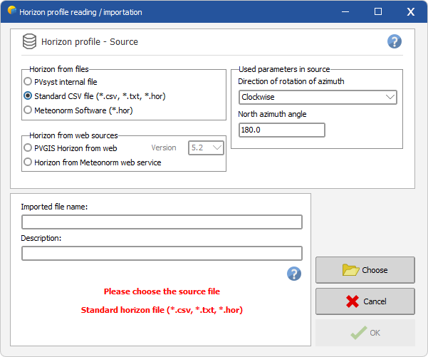
- Standard CSV file - any text file containing properly structured data. PVsyst will recognize files as valid horizon profiles if they meet following characteristics:
- File with text or CSV format, containing columns separated with comma, semicolon, tabulation or space
- Header/comments:
- All lines containing text are considered comment lines
- Comment line containing text such as "Latitude 25.3°, Longitude 44.1°" will be used as a comment for the generated horizon. This comment can later be manually edited.
- Data:
- One line per defined point. Each point defined as an Azimuth and a Height value, expressed in degrees.
- Header/comments:
- Before import, you can define the angular reference for your file with the Direction of rotation of azimuth as Clockwise or Counterclockwise and the North azimuth angle.
- File with text or CSV format, containing columns separated with comma, semicolon, tabulation or space
- The Meteonorm software produces Horizon profiles, which you can also import in PVsyst. The file name of these profiles holds the exact coordinates of the site evaluated.
From web sources directly (requires an active internet connection):
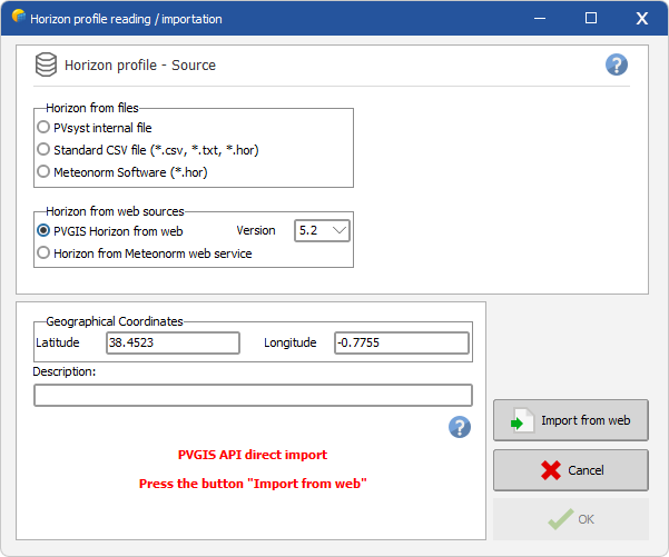
- The free service PVGIS (https://re.jrc.ec.europa.eu/pvg_tools/en/tools.html) provides worldwide horizons. This service is completely integrated in PVsyst, manually downloading the profile from the web page is not necessary. Simply choose "PVGIS Horizon From WEB" and press the Import from web button.
- The included Meteonorm web service for horizon profiles provides worldwide horizons.
- The SolarAnywhere® (https://www.solaranywhere.com/support/data-fields/far-horizon-shading/) web service provides worldwide horizons. Importing horizon profile with SolarAnywhere® API requires a valid API key. It is important to note that SolarAnywhere far-shading data aaccounts for the effect of nearby shading objects such as trees, building etc.
For horizon profiles established using a geo-reference grid (like PVGIS and Meteonorm), the exact location should be carefully defined. You can edit the latitude and longitude in this window to be as precise as possible: keep in mind that a degree in latitude is 111 km, the second decimal is 1.1km and the 4th decimal is 11m. The 4th decimal can still have a big impact in places with high slope.

